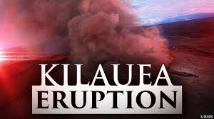
AERIAL photos of Hawaii’s Kilauea volcano show the magnitude of the lava continuing to flow out of fissures in the lower East Rift Zone. These dramatic pictures show the extent of the incredible lava flows which continue to ooze out of fissures on Hawaii’s Big Island. The United States Geological Survey has said lava continues to flow out of fissure 8 into a channel which is “nearly full to brim” in Leilani Estates. “Fissure 8 continues to fountain to heights of about 100 to 130 feet. Lava flows out of fissure 8 into a channel that is nearly full to the brim in the vicinity of the Leilani Estates subdivision,” the USGS said.“The lava travels about 8 miles to the ocean entry at Kapoho Bay and Vacationland.“The ocean entry is most active is most active in the Vacationland area, with multiple small lava streams spilling into the water, producing many small laze plumes.” The aerial images show the rivers of lava spouting out from fissure 8 moving down and entering the ocean. Lava has boiled away Hawaii’s largest freshwater lake in a matter of hours and sent a white plume high into the sky. The molten rock entered Green Lake on Saturday and creative a massive plume of steam, casing the body of water to fizzle away, the USGS reported.The lava had crept into the lake between 11.30am and 1.30pm local time (10.30pm and 12.30am BST) and had completely evaporated all of its waster by 3pm (2am BST Sunday, June 10). Kilauea – one of the most active in the world – began erupting on May 3, destroying about 600 to 700 homes and there are no signs of it stopping anytime soon. In the last two weeks, more vigorous lava flows have poured downhill to the coast, blocking roads and destroying hundreds of homes in the Kapoho and Vacationland areas. President Trump declared a major disaster area in Hawaii on May 11.On Monday, two explosions triggered a magnitude 5.4 earthquake and there continues to be explosions which shoot plumes of ash into the sky. USGS footage captured on Monday shows molten lava from Kilauea’s lower East Rift Zone entering the ocean. The aerial video shows lava releasing bursts of steam, hot water and tephra or molten splatter, called a “tephra jet.” The volcano has sent occasional columns of ash and volcanic gas into the atmosphere at between 10,000 ft (3,050m) and 30,000 ft (9,145m) above sea level, USGS said.A fissure in the volcano spewed molten rock 160 feet (49m) on Tuesday, slightly lower than the 180 feet (55m) it reached from Saturday night into Sunday, pushing a steady flow of lava into the ocean. Hawaii Emergency Management Agency spokesman Richard Rapoza said: “The summit itself is fairly stable, with continued seismic activity and a high likelihood of additional small explosions. “The lava flow is contained within a channel flowing to the ocean with only minor outflows.” The eruption entered its 41st day on Wednesday and stands as the most destructive in the US since at least the violent 1980 eruption of Mount St Helens in Washington state, according to geologist Scott Rowland. Hundreds of construction workers and volunteers, including officials from the Hawaii National Guard and the Hawaii Regional Council of Carpenters, began building around 20 temporary housing units in Pahoa for families forced from their homes.
